
Showcasing Large Commercial Properties: Why Ground-Level Photos Aren't Enough
A 200,000-square-foot warehouse doesn't fit in a smartphone photo. Neither does a 50-acre industrial park, a multi-building office campus, or a regional shopping center. Here's why aerial photography is the only way to market large commercial properties effectively.
Commercial real estate operates on a different scale than residential. The properties are bigger, the stakes are higher, and the buyers and tenants making decisions are evaluating assets worth millions of dollars — often from hundreds or thousands of miles away.
Yet a surprising number of commercial listings still rely on the same marketing approach that might work for a three-bedroom house: a handful of ground-level photos, a site plan PDF, and a hope that a serious prospect will schedule an in-person tour.
For large commercial properties, that approach leaves money on the table. Ground-level photography fundamentally cannot communicate the scale, layout, access, and context that drive commercial real estate decisions. Aerial drone photography can — and the data shows that it makes a measurable difference in how quickly properties lease, sell, and attract qualified interest.
The Problem with Ground-Level Photos for Commercial Properties
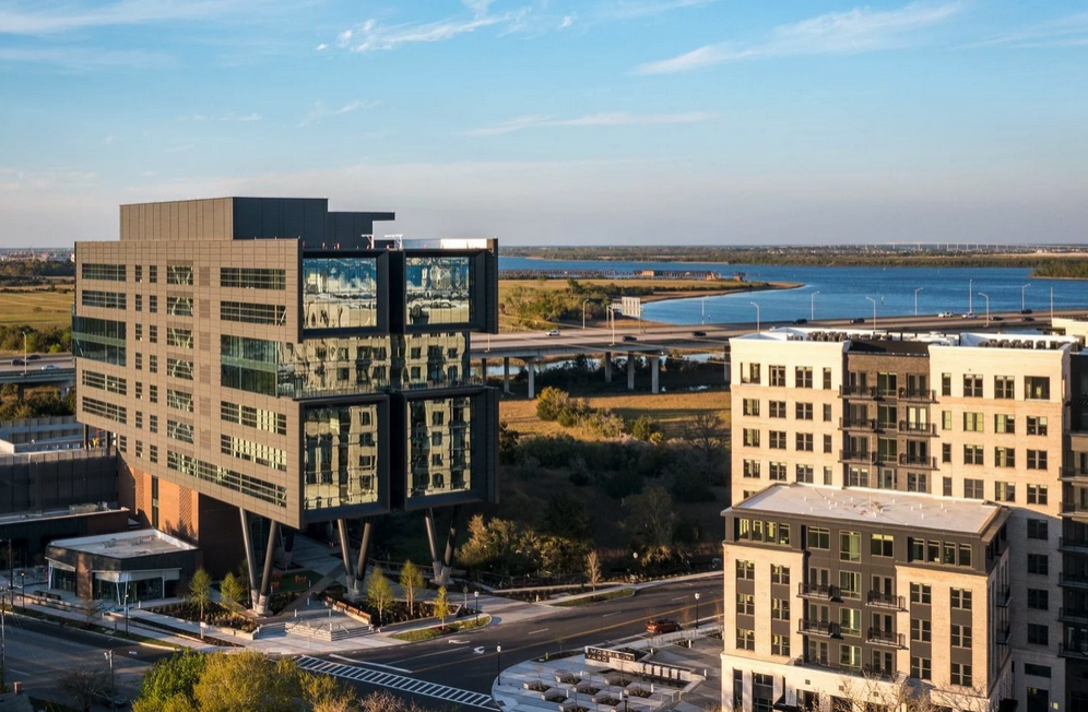
Stand in the parking lot of a 300,000-square-foot distribution center and take a photo. What does the viewer see? A wall. Maybe a loading dock. A strip of pavement. The image tells them almost nothing about the property's actual value proposition.
The same problem applies across every commercial property type. An office campus photographed from the front entrance looks like a single building — not the four-building complex with shared green space and structured parking that it actually is. A retail center shot from the street shows one storefront and a row of parked cars, not the 40-unit layout with dual highway access that an investor needs to understand. An undeveloped land parcel photographed at eye level is just a field — not the 75-acre site with rail adjacency and interstate frontage that makes it a prime logistics opportunity.
Ground-level photos capture fragments. Commercial buyers and tenants need the full picture.
What Aerial Photography Reveals That Ground Shots Can't
The value of aerial drone photography for commercial properties comes down to what it communicates that no other medium can.
Scale and layout. The single most important thing a commercial property buyer or tenant needs to understand is the full scope of what they're evaluating. How large is the building footprint? How does the site flow from entrance to loading to parking? Where are the multiple access points? How are the buildings arranged relative to each other? A single aerial photograph answers all of these questions instantly — questions that would otherwise require an in-person visit or hours studying a site plan.
Access and logistics. For industrial and retail properties, access is everything. Aerial photography shows highway proximity, road frontage, turning lanes, multiple entry points, and the flow of traffic around the site. For warehouse and distribution properties, it reveals dock counts, truck staging areas, laydown yards, and the relationship between the facility and the transportation network. These details are critical for logistics operators evaluating a site's throughput capacity, and they're invisible from the ground.
Surrounding context. Commercial property value is deeply tied to location, and aerial photography communicates location in a way that an address on a map cannot. An office building gains appeal when the aerial reveals a walkable plaza, nearby restaurants, and convenient highway access. A retail center looks more attractive when the surrounding residential density is visible from above. An industrial site becomes more compelling when the aerial shows rail adjacency, port proximity, or its position within an established logistics corridor.
Condition and maintenance. Aerial imagery provides a clear view of roof condition, parking lot surface quality, landscaping maintenance, exterior building condition, and drainage patterns — all factors that influence a buyer's assessment of capital expenditure requirements. These details are difficult and sometimes dangerous to evaluate from the ground, especially on large properties with extensive rooflines or multi-story structures.
The Numbers Behind the Shift
The commercial real estate industry's move toward professional visual content isn't based on aesthetics alone — it's driven by measurable results.
Properties marketed with aerial imagery sell 68% faster than those without, according to MLS data. Listings with video content generate 403% more inquiries. And brokers who incorporate video into their marketing grow revenue 49% faster than those who rely on traditional methods alone.
For commercial real estate specifically, the impact is even more pronounced because of how decisions are made. A joint study by Google and LoopNet found that nearly 80% of commercial tenants and investors use the internet to make lease and purchase decisions. When the majority of your prospects are evaluating your property digitally before they ever pick up the phone, the quality and comprehensiveness of your visual presentation directly determines whether that call gets made.
Virtual tours and 3D walkthroughs — often combined with aerial photography — push the engagement further. Listings with 360-degree tours receive 87% more views, and 95% of prospects are more likely to inquire about a property that offers one. Properties with 3D tours close up to 31% faster and at 4–9% higher prices.
For commercial properties where a single deal can represent millions of dollars, the ROI on professional aerial photography isn't marginal — it's exponential.
How Different Property Types Benefit
Aerial photography serves every category of commercial real estate, but the specific advantages shift depending on the property type.
Industrial and logistics properties benefit the most from overhead and oblique angles that reveal dock configurations, yard capacity, clear heights implied by roofline structure, and proximity to transportation infrastructure. For distribution centers and fulfillment facilities, where site throughput is as important as building square footage, aerial imagery communicates operational potential that interior photos and floor plans simply cannot.
Office properties gain from aerials that showcase campus layouts, parking ratios, outdoor amenity spaces, and neighborhood context. For suburban office parks, the aerial view reveals the relationship between buildings, green space, and access points. For urban office buildings, it establishes the property's position relative to transit, dining, and the surrounding business district.
Retail and mixed-use properties rely on aerial photography to communicate visibility, traffic flow, parking capacity, and pad site availability. An aerial image of a well-positioned retail center immediately conveys anchor tenant relationships, access from major roads, and the density of the surrounding trade area — all information that drives leasing decisions.
Land and development sites are perhaps the most underserved by ground-level photography and the most transformed by aerials. An undeveloped parcel that looks like an unremarkable field from the road reveals its true potential from above: boundary lines, topography, natural features, utility easements, and relationship to surrounding infrastructure. For developers evaluating a site's buildable area or investors comparing multiple parcels, aerial imagery is indispensable.
Beyond Marketing: Documentation and Asset Management
The value of aerial photography for commercial property owners extends well beyond listing presentations.
Regular aerial documentation creates a visual maintenance record for property managers tracking roof condition, parking lot deterioration, landscaping health, stormwater management, and exterior repairs over time. High-resolution imagery captured from above can identify potential issues — ponding water, membrane damage, vegetation encroachment — before they escalate into costly repairs.
For properties undergoing renovations, expansions, or tenant buildouts, periodic drone flights provide construction progress documentation that protects both the property owner and the contractor. Time-stamped aerial records of site conditions at every phase of a project become invaluable if disputes arise about timelines, workmanship, or change orders.
Insurance documentation is another growing application. Detailed aerial imagery of a commercial property — including roof condition, exterior surfaces, and drainage infrastructure — provides a comprehensive visual record that supports claims processing and underwriting more effectively than ground-level photos or written descriptions.
The Remote Investor Advantage
Commercial real estate is increasingly a remote business. Investors and institutional buyers routinely evaluate assets across state lines and time zones, and the properties that make their shortlists are the ones that provide the most comprehensive digital presentation.
Aerial photography and video give remote decision-makers the ability to assess a property's physical attributes, location context, and condition without scheduling a cross-country site visit. For portfolio investors reviewing dozens of assets simultaneously, drone footage allows them to revisit and compare properties as many times as needed — something a single in-person tour can never replicate.
In a market where 80% of commercial tenants and investors are conducting their initial evaluation online, the properties with the strongest aerial presentation don't just attract more interest — they attract more qualified interest from prospects who already understand what they're looking at before the first conversation.
What a Professional Commercial Aerial Package Includes
An effective aerial marketing package for a commercial property goes beyond a few photos from a drone. A comprehensive shoot typically includes high-altitude establishing shots that show the property within its regional context, mid-altitude imagery that details the site layout and building relationships, close-range aerials of key features like loading areas or amenity spaces, and a cinematic video flyover that creates a narrative experience for the viewer.
The most effective commercial presentations combine multiple perspectives into a cohesive story. A typical property video might open with an establishing shot showing regional context, then move closer to reveal the property within its immediate surroundings. Adding motion graphics with labels for major roads, anchor tenants, or nearby infrastructure helps viewers orient themselves quickly. Property boundary overlays clarify exactly what's included in the listing.
For larger or more complex properties, orthomosaic mapping and 3D modeling add additional layers of information that sophisticated buyers and tenants have come to expect.
The Bottom Line
Ground-level photography was designed for a world where commercial properties were marketed with brochures and seen in person. That world is gone. Today's commercial real estate prospects make their initial evaluations on a laptop screen, often from a different state. The properties that win their attention — and ultimately their offers — are the ones that communicate their full value from the only vantage point that makes sense for large-scale assets: above.
For commercial property owners and managers who are still relying on ground-level photos and static site plans, the gap between your property's actual value and how it's perceived online is wider than you think. Aerial photography closes that gap.
Carolina Aerials LLC provides professional aerial photography and video for commercial properties across the Carolinas — from industrial parks and distribution centers to office campuses, retail centers, and development land. We work with property owners, managers, and brokers to create aerial marketing assets that match the scale and quality of the properties they represent. Contact us today to discuss your commercial property.
Ready to Elevate Your Commercial Property?
Professional aerial photography for commercial real estate across SC, NC, and GA.
Commercial Photography Schedule Your Shoot